Ancient Lakebed Supports Farming
Why this is here: The Dominion Land Survey divided roughly one square mile sections of western Canada after the government purchased Rupert’s Land in 1869, and its grid pattern remains visible in the arrangement of farms and roads.
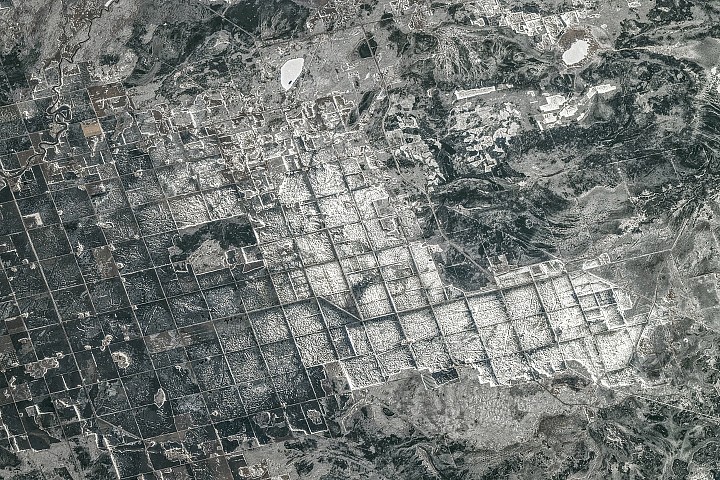
An astronaut aboard the International Space Station photographed farmland in southeastern Manitoba, Canada. The area once lay at the bottom of Lake Agassiz, a massive body of water formed roughly 15,000 years ago by the retreating Laurentide Ice Sheet. Lake Agassiz covered an area larger than all the Great Lakes combined, stretching across parts of Manitoba, Ontario, Saskatchewan, North Dakota, and Minnesota.
The lake began draining around 12,000 years ago, leaving behind thick deposits of nutrient-rich silt and clay. These former lakebeds now support productive agricultural land, growing crops like wheat, barley, oats, and canola. A systematic land survey from 1869, called the Dominion Land Survey, further shaped the landscape with its one-square-mile grid pattern.
The photograph, taken on April 19, 2026, reveals snow and ice cover, contrasting with darker forests and wetlands. While the survey system is still visible today, researchers continue to study the long-term effects of glacial lake drainage on the region’s ecology and agricultural potential.
Surfaced by the Recovery lens — one of the vital signs ovr.news reads.
How we evaluated this
AI summary
read the original for the full story — Read on science.nasa.gov . How we work →