UN approves map that accurately shows Africa’s size
Summary and headline written by AI from the source article. How we work
The United Nations General Assembly approved a resolution calling for a shift away from the Mercator map projection, after a proposal from Togo and the African Union.
On September 4, 2026, the assembly voted 164 to 1, with six abstentions, to encourage governments, schools, and tech companies to use maps that show continents in accurate proportion. The Mercator projection, created in the 16th century by Gerardus Mercator, maintained accurate angles for compass navigation, making it useful for sailors.
Although the usefulness of the Mercator projection has diminished with the advent of GPS, it remains common on maps like Google Maps and OpenStreetMap. However, the projection exaggerates the size of landmasses further from the equator, visually inflating the size of Greenland compared to Africa, the former appearing larger despite being fourteen times smaller. Proponents of the new resolution argue this distortion promoted a Eurocentric view of the world.
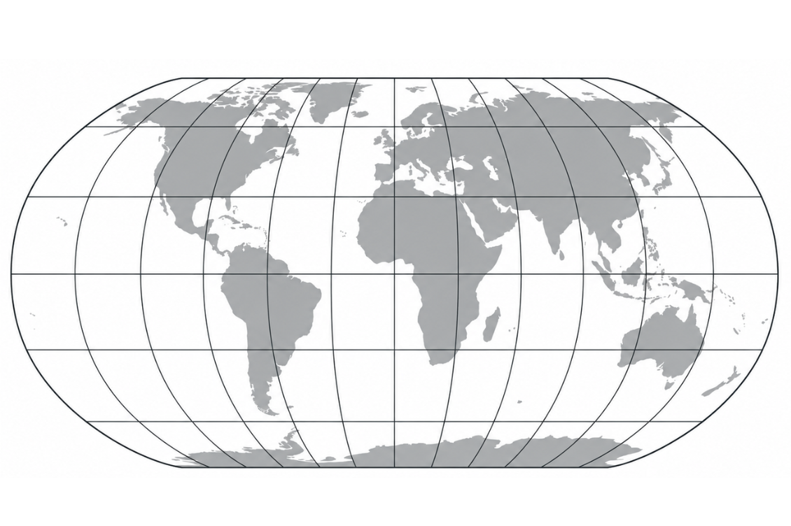
The UN is now recommending the Equal Earth projection, developed in 2018, which aims to balance accurate proportions with familiar continental shapes. Togo plans to host an event with UNESCO and tech companies, including Google, in early 2027 to plan implementation. The African Union chose to promote Equal Earth in its member states’ schools in 2025. While the resolution isn’t binding, it signals a desire to challenge existing power dynamics reflected in cartography.