AI agents discover unmapped Maya pyramid in Mexico using NASA lidar data
Headline and summary by local AI
A researcher used 48 AI agents to identify a previously unmapped Maya archaeological site in Mexico within 72 hours.
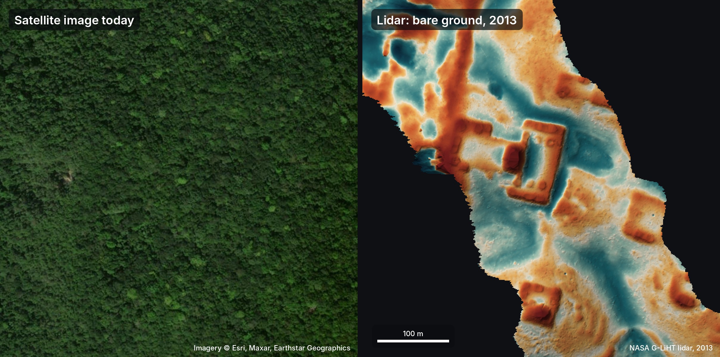
The researcher analyzed public lidar data from NASA to find ancient structures hidden beneath the jungle canopy. Lidar technology works by firing laser pulses through trees to map the ground surface. The researcher tasked AI agents from models including Gemini, ChatGPT, Claude, and Grok to scan approximately 1,200 km² of jungle.
These agents processed the lidar strips into images and identified human-made shapes like pyramids, platforms, and plazas while ignoring natural features like sinkholes and hills. The AI agents identified a specific hilltop site featuring a leveled plaza, an oval pyramid between 8 to 12 meters tall, a raised courtyard, and a potential water reservoir.
The researcher collaborated with the AI to draft a formal report in Spanish and submitted it to the National Institute of Anthropology and History (INAH) in Mexico. The Mexican government confirmed that the site was not currently registered in their records. The site appears to be a small Maya civic center from the Classic period, which spanned roughly from AD 250 to 900. The researcher offered to assist with a field check led by the INAH.
Because archaeological sites in Mexico are protected by federal law, the local INAH center must now decide whether to authorize and send a team to the location.
Selected and summarized by local AI How we work
Discovery: Archaeology, new knowledge of art, culture and history, forgotten history uncovered, something lost restored.